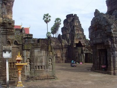
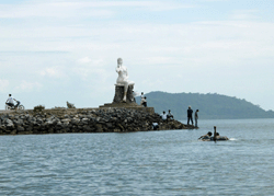
Daily Archives: March 7, 2011

Kratie Province Tour Destinations

Phnom Sambok Resort
Is the natural and historical resort, locates at Thmor Kre Commune, Kratie District in 11-Kilometer distance from the provincial town by the National Road No 7, then turning more

500 Meters to the mountain. Phnom Sam Bok is the cultural and main tourist resort of Kratie province. The resort has good location and assured safety for tourists to visit. Phnom Sam Bok has been arranged as the tourist resort since the Sang Kum Reas Ni Yum time. The special features of Phnom Sam Bok are:

• Closed to the western mountain foot, there is a big pond full of clear water and natural plants.
• The mountain has two peak, a dull peak and a pointed peak. On the mountain top, we can view the beautiful scene especially the Mekong River.
• The mountain rich in big trees and birds.
• There is a concrete stair stretching from the mountain foot to the top, and there are many resting place at the mountain.

The legend said that one upon the time, there was a king named Cha Krey Sara Varman a son of Preah Bat Hathak Athi Reah Varman. After he was on throne instead of his father, he informed officials and high officials to find where having gold mine. Then they found a place closed to the mountain foot of Sam Bok very rich in gold. The local people there called the place “Kan Leng Sam Bo Meas” means “a place very rich in gold ”. Long time after that, the word changed to “Phnom Sam Bok Meas ”, then only “Phnom Sam Bor” until now.

The background of Phnom Sam Bok: At the beginning of 15th century, there was a monk named Neak Voan, the student who has the same teacher to the monk, Neak Sen. Neak Sen is the teacher of crocodile, Nen Thun and he does meditation on the mountaintop of Sam Bok. The monk, Neak Voan has very strong ritual formulas and he is well known to the near and far local people. The local people accompany each other to learn the ritual formulas from Neak voan. Since that, Phnom Sam Bok becomes the worshipping place until now.

The 100-Column Pagoda
Located at Sam Bor District in 36-kilometer distance, North of the provincial town by the National Road No 7. The special features of Sar Sar-100 pagoda are:

The 100-column pagoda was built on the place where the Royal Palace temple of Sam Phu Borak Capital of the Chen La time located. At the area, there are four-Buddist temples facing to different directions:
• Vihear Lao faces to the West
• Vihear Sar Sar-100 faces to the North
• Vihear Kork Keut faces to the East
• Vihear Kork faces to the South (this Buddhist temple has only base and mark remain).

During the Khmer New Year, the local people who live near the former sam Phu Bo Rak Capital usually celebrate the four-day festival by starting at Vihear Sar Sar-100 first, then Vihear Kork and Vihear Lao lastly.

Background of Vihear Sar Sar-100: Was built in 1806 and the size is 30 Meters x 30 Meters. In the former time, at the 100th column, was thatched by Preah Ang Chan Reachea II for dedicating to the power of Vihear sar sar-100 to maintain the soul of Preah Neang Varakak, his daughter who was swallowed by the crocodile, Nen Thun. Vihear Sar Sar-100 is different to other temples because it faces to the North. About 100 years later, the temple was damaged by the strong lightening, which caused 22 columns burnt down and the statues dirtied by smoke.

Because of this incident, the temple was pulled down and rebuilt by the local people, but it had only 78 columns. Until 1987, the 100-column pagoda has once again been renovated with 35-meter length, 18-meter width, 23-meter height and 116 columns; also, the temple has completely been renovated, inaugurated and Sey Ma buried on January 14, 1998.

Related Post

Kompong Thom Province Tour Destinations

The central point of Cambodia
Situated in the central of Cambodia, Kompong Thom is a pleasant country town where visitors can have plenty of activities. The town is well situated as a crossroad to the important sights of Angkor temple complex, Prea Vihear Temple, and the ancient capital of Sombor Prey Kuk. The town has a nice layout and is situated on the banks of the Sen River, which is a long, winding body of water that originates in the Dangrek Mountains.With its 13,814km² populations of 642,932, comprising 310,150 males and 332,782 females. The percentage of female’s population is about 52. The province consists of 8 districts, 81 communes and 737 villages. The district of Stung Sen constitutes the urban portion of the province.
Sambo Preykuk Temples
Sambo Preykuk is a cultural and historical site located in Sambo village, Sambo commune, Prasat Sambo district, about 25 kilometers northeast o Kampong Thom provincial town. The site was once an old capital named Isanapura and a religious center for the worship of Shiva Brahmanism.
Many temple were built in Sambo Preykuk during the reign of King Isanavarman I (AD 616-635) in the 7th century, The temple o Sambo Prykuk constructed of solid brick, laterite and sandstone and decorated by bas-reliefs. The lintel, pillars and the door frames are all made of sandstone. So far, 140 temples have been discovered in the forest. Sambo Preykuk temples are divided into four main groups:
The Central Temple
The central temple is called Tor1temple, or the lion temple. There are sealed doors on three sides and a real door that opened on the north side. On each side is a set of stairs between two statues of kneeling lions. There are a number of small temples west of lion temple. The lion temple was built in 9th century.
The Northern Temple
The northern temples are called mid-Sabo temples and are surrounded by many small temples.
The Southern Temple
The southern temples are called Yeay Poan temples, They, too, are surrounded by many temples. There are ramparts, which the inner rampart has four gopuras2 on each side. This site was a former capital.
Kraol Romeas Temples
Kraol Romeas temples are about 2 kilometers north or Sambo Preykuk. All were built or brick, except the temple to the west, which made of laterite. To conserve the temples, three areas are designated as protected sites for the purpose o conserving the temples. They are marked as follows:
First Area: the first area covers 30 meters outside the rampart.
Second Area: the second area covers 300 meters outside the first area.
Third Area: the third area covers 1,500 meters outside the second area.
Kuhak Norkor
Kuhak Norkor is located in Trodork village, Pongro commune, Baray district, about 96 kilometers from Phnom Penh. The site covers 200 square meters, Kuhak Norkor temple is located on the grounds of Kuhak Norkor pagoda. The temple is 45 meters long and 35 meters wide, similar to Tonle Bati temple.
Constructed of sandstone in the 11th century, during the reign o King Suryavarman I, it is surrounded a 3-meter high sandstone rampart. The temple is divided into three parts–the first part is a meters high, the second is 12 meters high, and the third is 15 meters high.
Phnom Santuk
Phnom Santuk is a cultural and natural site located in Ko koh village, Ko Koh commune, Santuk district, about 17 kilometers south of Kampong Thom provincial town. These site include four mountains: Phnom Srah Kmao or Phnom Tbeng, Phnom Penchu or Phnom Kraper, Phnom Champa and Phnom Santuk.
On the top of the 180-meter high mountain, is a pagoda known as Wat Kirichaomchong Phnom Santuk. The pagoda gate at the roof of the mountain is very beautiful. This pagoda itself is reached by climbing an 809-step staircase that features a long concrete hand rail in the shape of Prohm carrying naga, which was constructed in 1996. Along the staircases, there are many big threes and large stones. Though a long hike, there are four points of interest on the climb the mountaintop:
– At 230th step, there is an access to a rock valley and a well.
– At 455th step. there is a resting hall to the left, which has a Buddha statue.
– At 620th step, there are large rocks and threes to offer shade or weary climbers.
– At 694th step, there are a number of huge rocks at the right known as Chanre. Between the rocks is a slit about 5 centimeters wide, 3 meters long and 6 meters deep.
To reach the pagoda, visitors can take either the old or new staircase from Chanre spot. The main temple of the pagoda covers from 16 square meters. North of the pagoda, there is a worship hall that covers 144 square meters. Made o concrete, it has a ceramic a tile floor and a red tile roof. Behind the pagoda, there is a Chinese temple that faces east. it house a Bodhisattva Guan Yin3 statue.
Behind the temple, there are five statues of the reclining Buddha reaching nirvana and 99 smaller statues. In front of the temple, there are many other statues, including Preah Bat Chaon Tuk, The Buddha’s footprints, Chan Re’s Mother’s Breast statues, and Chhat Ruot, a multilayered umbrella. Nearby is a statues of Eysei Akinet, where local people often worship.
Next to Phnom Santuk is another mountain, Phnom Srah Khmao, which has an old brick temple and a bat cave on the mountaintop, where everyday, between 5 and 6 p.m thousands of bats fly from and into the countryside.
Prey Pros
Prey Pros is a semi natural and natural site in Prey Preal village, Prey Preal commune. Kampong Svay district, about 16 kilometers northwest of Kampong Thom Provincial town. The site encompasses 2 million square meters and includes a river that is 4,000 meters long and 30 meters wide. It is rich in Domrei fish4.
The site is a venue for foot races, bicycle races and other games during national festivals. In addition, the provincial tourist office has organized other activities such as boat rides, fishing and swimming, and has erected resting cottages, where foot and drink are or sale. The view from Prey Pros is beautiful and enchanting, while the wind that blows across the river will cool and refresh hot, tired tourists.
Wat Prasat
Wat Prasat is located in Prasat village, Prasat commune, Santuk district, about 135 kilometers from Phnom Penh or 31 kilometers southeast Kampong Thom provincial town. At one time, there were seven ancient temple at Wat Prasat but today, only one is still standing. It is located behind the recently built temple.
Constructed of the brick in the 7th century, Wat Prasat temple is 3 meters square in diameter. On the temple doorframe is a flower wreath similar to the one at Sambo Prey Kuk temple. in the temple, setting it apart from other temple.
Wat Kampong Thom
Wat Kampong Thom, also known as Wat Inndrisamavora, is located in Kdel village, Preykahu commune, Stung Sen district, about 1 kilometers from the provincial town. This old temple is a holy place that covers 2,053 square meters. Statues related to the Buddha story can be found in the pagoda. The pagoda fences are painted in many different to relax, especially during festivals.
Wat Kdei Deum
Wat Kdei Deum is located in Prasat village, Sanko commune, Kampong Svay district, about 127 kilometers northwest of Kampong provincial town. A holy place, the site feature two ponds and includes an old temple similar in style to Banteay Srei temple in Siem Reap.
Wat Prasat Andet
Wat Prasat Andet is located in Prasat village, Sanko commune, Kampong Svay district, about 27 kilometers northwest of Kampong Provincial town. Wat Prasat Andet includes an ancient brick temple constructed in 6th and 7th centuries during the reign Isanavarman I, dedicating to Brahmanism. The grounds at Wat Prasat Andet are spacious and abundant in koki trees. In addition, the grounds have never been flooded.

Related Post

Kompong Speu Province Tour Destinations

Situated in the plateau mountains region, Kmpong Speu Province with its 7,017 km² and a population of 681,456, comprising 329,159 males and 352,297 females. The Province consists 8 districts, 87 communes and 1,308 villages. The District of Chbar Mon constitutes the urban portion of th province.
Ampe Phnom
Ampe Phnom is a natural and cultural site located in Tang Tonle and Ampe Phnom Village, Soportep and SVAY Kravan communes, Chbarmon district, about 48 kilometers southwest of Phnom Penh. The site feature are stream, walking paths and big shade tree. A wobbly, wood-and –cable suspension bridge across the stream links Tang Tonle and Ampe Phnom villages.
On the Ampe Phnom side of the stream sits an old pagoda where Cambodians worship during festivals. Visitors can swim in the stream, traverse the suspension bridge or simply relax in one of the many cottages above the stream. Food and beverages are available for sale, and the surrounding woods are full of monkeys.
Preah Soramrith Kosamak Kirirom National Park
Preah Soramrit Kasamak Kirirom National Park is on Kirirom Mountain, in Damrei Phnom Village, Kirirom commune, Phnom Sruoch district, about 117 kilometers southwest of Phnom Penh. The mountain is 700 meters high. A natural site, it once was Preah Kosamak town. This well-conserved park, abundant in fresh air, has waterfalls and is full of tall pine trees and orchid flowers.
There are not many types of larger wildlife in evidence on Kirirom, but it is an ideal spot to glimpse some of the country’s unique birdlife and birdwatchers even come from overseas to visit. The national park is more interesting during or just after the rainy season; not that many fires on the ground and waterfalls having well water.
Kirirom Hillside Resort
Near the foot of the mountain is the Kirirom Hillside resort, where offer visitors a wide variety of leisure activities and facilities such as: Hotel, restaurants, zoo, waterfall, family shopping mart, recreations and children playground beautiful Dino Park, fishing, canoeing, hors riding, biking and rope sliding,. Visitors can also plays sport such as tennis and basketball at the resort. In addition, stream, sauna, spa, swimming pool and fitness center are available beside conference and banquet facilities.
Chambok Ecotourism Site
Chambok ecotourism site is just nest to the Kirirom National Park. Be prepared for some exercise about 4 kilometers trek, interaction with local villagers, and discovery of Cambodia’s unique natural biodiversity, visitors will enjoys with other activities such as: hiking, ox-cart riding, renting bicycle, picnicking, bird watching, bathing at the stream and the waterfall, and visiting a bat-cave. Furthermore, visitors can possibly have a lunch in the villager’s house prepared by local women, including fruit and coconut at the waterfall.
Phnom Prey Khmer
Phnom Prey Khmer is located in Khmer Por Village, Kram Por commune, Phnom Sruoch provincial town, about 22 kilometers southwest of Kampong Speu provincial town. It is a natural site composed of small, rolling hills that accessible by car, on the hilltops are kiosks where visitors can relax. Until recently, this site was largely unknown to tourist.
Te Teuk Pus Hot Spring
Te Teuk Pus Hot Spring Is located in front of Phnom Te in Phnom Te village, Sangke Sap commune, Oral District, about 60 kilometers west of the provincial town. Hot Spring are rare in Cambodia. Te Teuk Pus is 100 meters in diameters. The surface of the water, which comes from six sources and smalls like sulfur or limestone, is 80 square meters. The water temperature is degree s Celsius.
The entire site covered 5 hectares and is full of tall grass, Kok1 and red rock. Local villages, who are members of the Kuoy minority hill tribe, believe that the hot spring is effective for curing all kinds of illnesses and skin diseases, as well as sorcery. Washing one’s face with water from the spring is believed to bring good luck.

Related Post

Kompong Cham Province Tour Destinations

Nokor Bachey Temple
Nokor Bachey temple is a cultural and historical site. It is located 2.2 kilometers from Kampong Cham provincial town along National Road 7, about 122 kilometers northeast of Phnom Penh. Visitors traveling from Phnom Penh will see the gate to the pagoda on right. The temple was built in the middle of the 11th century, during the reign of Suryavarman II and King Ouphey dedicating to Brahmanism. The temple is about 200 meters inside the gate. The site is accessible to almost all type of vehicle. The temple is divided as followed:
Preah Theat Teuk Chhar
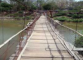
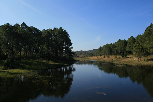
Preah Theat Teuk Chhar is a group of Temples in Thmo Da villages, Beung Nay commune and Thmei village, Krouch commune in Prey Chhar district, about 39 kilometers from Kampong Cham provincial town. Visitors can reach Preah Theat Teuk Chhar by taking National Road 7 from Kampong Cham, turn right at the provincial road and drive 13 kilometers before turning right again and driving another 5 kilometers along a canal trail, to the temple site.
The temple were constructed in AD 1005, during the reign of King Suryavarman I. as proposed by King’s adviser Chung Chheal4,the King agreed to build these temples and Leaksintra started construction on the site called Sithiboriya that which owned by the king, who also contributed money. Leaksintra, however, used his salesmanship to encourage the local people to contribute the money as well, until the project was finished.
Once of the temples houses a Shilva lingam named Sreipatresvara and two divinity statues Paramesvara and Sarasvata at both side. another cave like temple believed to house a god is located along a canal, near a waterfall. badly damaged over the years, only one door remains today, and it is overgrown with vegetation.
The architect excavated a large pond on the right side of the temple called Leaksintrada. a golden Silva lingam was kept in the middle of the pond. nearby, a village of wealthy people was formed, in addition, people from nearby villages were invited to live there, too, the village soon became a crowded but cheerful town.
Leaksintra told the king of the new town, and the king went there to celebrate the town’s inauguration in AD 1025. he gave the city numerous gifts, including 29soldiers and a rice field that surrounded the temple. he had pond dug and a huge court built for the festival celebrations, and he gave decorations for the temple. he named the site Leaksintrabot in honor of its architect, Leaksintra.
Later, the site became a place for religious worship. The religious practiced changed from king to king, some king practiced Brahmanism, while some practiced Mahayana Buddhism. Other were Theravada Buddhists, which explains why there are so many small temples at Preah Theat Teuk Chhar. All told, there are 551 small temples which are influenced by Brahmanism and Buddhism. some of the temples contain statues of heroes who gave their lives for the nation.
Many of the temple were destroyed by years of war. others were heavily damaged. today, monk and visitors to the site search in hopes of finding the name and foundations of these temples so they might be rebuilt. Some temples have been rebuilt already, their foot and tile roofing replaced with concrete.
Thom temple
The site of an ancient temple is at the top of the hill. it includes three structures built of solid brick. one of the structures is no longer standing , while the other two remain, along with some ancient statues and other subject related to Brahmanism. a relatively new temple site on the same terrace, not far from the ancient structures. Villagers who live near the site believe that the ancient temples are protected by magic objects, and if visitors do not pray to the objects, their photographs will not turn out.
Preah Theat temple
Preah Theat temple is east of Thom Temple. It include six ancient temples. Of this six five were destroyed by war, and the remaining temple has nearby collapsed as a result of thieves digging for treasures. Northeast of Thom Temple is Preak Theat pond. In ancient times this pond was a canal.
Koh Andet Koh Prak
Koh Andet Koh Prak is an island inside a pond, north of Prey Nokor village. It is 30 meters long and 20 meters wide. It is also known as Srah Teum.
The Rampart
The rampart surrounds Prey Nokor Knong-Krau city, it consists of a complex of wild bamboo that was planted to block access to the city. The rampart was originally10 meters high and 15 meters wide. each site is 2,500 meters long. Some part of the rampart have been damaged.
This ancient site is popular among animists and tourists who wish to pray and enjoy traditional games during traditional festival days.
Wat Preah Theat Thma Da Temple
Wat Preah Theat Thma Da Temple is an ancient site located in Preah Theat Thma Da village, Preah Theat commune, O’Reang Oav district, about 38 kilometers southeast of Kampng Cham town. Take National Road 7 form Kampong Cham town, Turn right at National Road 11 and continue on to O’Reang Oav district. The site is 8 kilometers trail down a dirt trail.
Wat Preah Theat Thma Da temple is 190 meters long and 160 meters wide. The temple includes Preah Theat temple and a pond that s 180 meters wide and 950 meters long .The water is in the pond is very clear. It is called Tonle Sa Ngout. along the entrance to the Tonle is another temple called Preah Vihear Preah Chul Nipean. at one time there was a statues of the reclining reaching nirvana, but the statues was stolen.
There are a number of statues in Wat Preah Theat Thma Da that local people worship. they include the statues of Atitap Vero, Kongchak, Hekpous, Srei Krupleak, Tuosmuk and Angkrong Pleung.
Behind the temple there is another hall Meru Mena built during French colonial time. At the front door there is a lintel5 that is sculpted on sandstone. Much of it has been damaged. inside Meru is a sculpture of Haothi Neang Umaparvati, which the Brahmans worshiped. It is believed that if the coconut dropped into the hole inside Meru, the coconut will appear in the middle of the pond. Meru was built was on the site of an old temple.
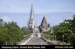
Phnom Pros Phnom Srei
Phnom Bros is a dull peak hill about 30 meters high. on the hill is a pagoda named Wat Sovankiri Rattanak Phnom Pros. it has a spot for vehicles to part at the top. the main temple is five peaks, constructed in the style of Banteay Srei temple in Siem Reap. another temple on the Phnom Pros has two peaks and was constructed during the Sangkum Reastre Nyum regime of then-Prince Norodom Sihanouk.near the temple is a 15-meter-high stupa, which was constructed by a monk named Keo Suor, who was the first head monk of the pagoda. a Kot is at the foot of the hill.
From 1975 to 1979, during the Khmer Rouge regime, Phnom Pros was used as a prison and torture center.about 1.000 meters north of Phnom Pros, there is another higher hill with a sharp-pointed called Phnom Srei.there is also several smaller hills at Phnom Srei called Phnom Dangrek, Phnom Ly and Phnom Chhuk. visitors can reach the peak by climbing308 steps. at the top are the remnants of a destroyed temple. no monk live there, however, there is a Daun Chi2 who cares for the site and asks visitors for donation to rebuild the temple.
This site popular with Cambodians during traditional festivals like Khmer New Year and Pchum Bin. the top of the hill affords visitors a beautiful view of Kampong Cham Province.
Phnom Han Chey (Phnom Chey Kiri)
Han Chey or Phnom Chey Kiri is located in Han Chey village, Han Chey commune, Kampong Siem district, about 18 kilometers east of Kampong Cham provincial town on the northern part of the Mekong River. The distance by water is 20 kilometers.
The top of the mountain is located by climbing 295 steps. On the top of the mountain there is a pagoda and temple known as South Kuk temple. Constructed of solid brick made of red clay, it is 7 meters square and 12 meters high. South Kuk temple was built in the seventh century during the reign of King Isanavarman I. Much of the temple has collapsed. Next to it is a second temple made of sandstone. It is 2 meters cubic in circumference and has a roof.
At the foot of the mountain, there is another temple made of basalt called Neang Khmao temple or Noth Kuk temple. It is 7 square meters. Today this temple is near collapse, because it has not been maintained.
Many tourists visit these sites many foreigners prefer to come by water, and they often travel in groups. Phnom Han Chhey is 63 meters high offers the tourist beautiful views of the countryside and Mekong River from it submit.
Phnom Cheung Prey Temple
Phnom Cheung Prey, which has a long history and beautiful scenery, has become a popular destination for tourist. It is located in Rovieng village, Rovieng Commune, Cheung Prey district, about 56 kilometers west of Kampong Cham provincial town. It is only 2 kilometers off National Road 7, on a gravel trail.
Most visitors who visit Phnom Cheung Prey believe that the hill has a magical object. local villagers are very superstitious about the hill and they pray at the temple on the top of it. Mr. Meun Met, a 40-year-old astrologer and traditional medical practitioner, said that, based on his observation, most visitors come from Phnom Penh, while only a few come from Kampong Cham provincial town and nearly districts. Most of these people, Meun Met said, come for medical treatment and to pray to the spirit, such as Neakta Krahom Ko.
Phnom Cheun Prey was divided into two hills. the eastern hill is called Phnom Srei or Phnom Thom, and the western hill is called Phnom Pros or Phnom Preah Bat. they about 500 meters apart.
On Phnom Srei, sits an ancient temple made of laterite and built in 12th century. All but 30 person of the temple has been destroyed. The hill is accessible by three sets o stairs–on th north, the south and the east side. Phnom Srei is 40 high, while Phnom Pros is only 30 meters. Cars can travel to the top of Phnom Pros.
According to Khmer folklore, the story of how Phnom Srei Phnom Pros came to be is similar to the story of the story o Phnom Pros and Phnom Srei in Kampong Siem district. in both cases, men and women competed to see who could build the taller hill. in this story, however, the place where the women drug the earth to build their hill become a big pond called Srah Teuk Preah, which can hold the water for the entire years, meanwhile, The place where the men dug the earth to build their hill became a big pond that holds no water. That pond is called Srah Kampeng Sanguot. It is said that Srah Kampeng Sanguot has no water because the women put a curse on it.
Next to Srah Teuk Preah is another pond, 50 meters squares and 4 meters deep. It is called Srah Leang Cheung6 before climbing the hill, people wash their feet there. There are many object on the hill, including a Buddha’s footprint stone, which Buddhists believe to be a magical object, Key Neang Teav Stone, stone of Ta Preng’s footprint, Khun Chhang’s place, and west of the cave there is a stone hole called Ronlor Ta Preng. there is also a rampart made of laterite that encircles the hill. at one time the rampart was 4 meters wide and 6 meter long on each side, but now only parts remain.
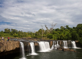
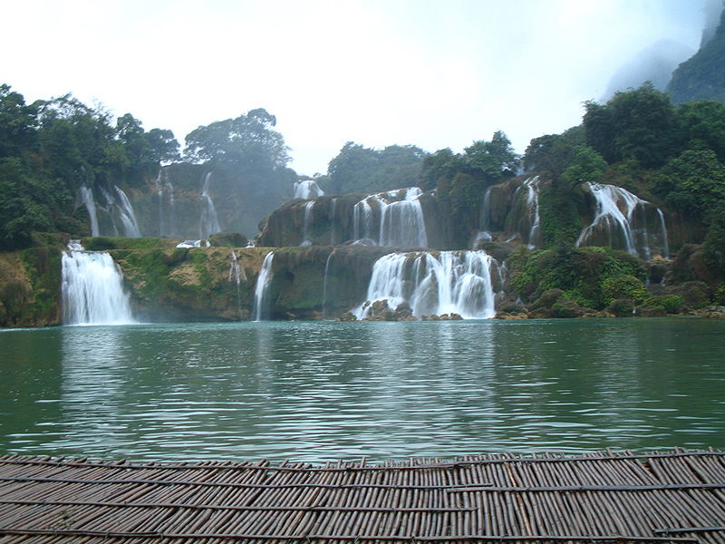
Haong Waterfall
The site is a mountain that features a cliff and waterfall. Inaccessible at one time, it has become a popular tourist destination in Kampong Cham province, there might be no other place Haong in the province, where visitors can see real nature. Those who has visited will never forget the jungle and the beautiful waterfall that is perfect for swimming. Buddhist come there to pray to the Buddha statue and to seek blessings from the monk who live there.
According to local authorities, there are 1,800 hectares of jungle at Haong. Some of the Trees has been cut by local villagers to clear land to farm. Haong is in Memut district on the border of Tambe district, about 90 kilometers east of the provincial town. the visitors either take a tour there or travel with a group of people.
At one time, Haong was entirely jungle. Then a monk maned Prak Mony arrived there, And Haong began to change. Today, monks live there and a pagoda is being built. a visit to Haong is an unforgettable experience.
Chhrouy Chek
Chhrouy Chek is a name of the place that was built for stocking water to irrigate the rice fields. Its beautiful flora and water sources have made it a popular location for Kampong Cham dwellers to visit, Especially on weekends and holidays. Young people in particular enjoy swimming there.
The site is about 15 kilometers from the provincial town, north of Kampong Siem district. the road is good, and there are lots of food stands along the way. Some food can be serve with no waiting. there are also floating houses that can be rented for 2,000 riel (USD 0.50), Where visitors can sit and relax. Boats are also available to rent.
Chhrouy Chek dam was built from 1975 to 1978, during the Khmer Rouge regime, for the purpose of storing water to grow rice during the dry season. Many Cambodians died while building the dry season. Many Cambodians died while building this dam, and others were killed by the Khmer Rouge. The place where they died is called Prey Tranoab.
Teuk Chhar
Next to Preah Theat Teuk Chhar temples is a canal dug during ancient times. water fill the canals years round and the water is very clear and free-flowing, making it popular with theorists who enjoy bathing in it. At one time, there were many trees and plants along the both side the canal, but they were removed to make a big plain, where the water alongside the main temple.
Today, the ancient pond designed by Leaksintra is a vast source of the water that is contained by the dam built several years ago. the water that fill the canal flow source from Kampong Cham Province, pass the temple and into the big slit, which for many years has been full of water that irrigates the rice fields of nearby villages such as Kroch village in Prey Chhar district.
Because the canal is old, the Ministry of Agriculture has built a dam to store water to supply thousands of hectares of rice field in Prey Chhar district, Kampong Cham Province and Baray district in Kampong Thom Province.
The surface of the Teuk Chha is 3 square kilometers. The water that fills it comes from about ten sources in the mountainous northeast and the plateau region, which is called Kbal Teuk, this basin has an average depth of 2 meters, the water flows through tree channels. any two of the channels can be closed one time, allowing the water to flow into the third channel and into the dam.
Because the canal of Teuk Chhar is angled like a carpenter’s tool, people can swim there. Since the water is clear, visitors can watch the schools of small fish swimming opposite direction of the water flow. In addition, the trees that line the canal bank hold many bird and provide shade and shelters to visitors. The cool climate along with the water and the big trees that surround the ancient temple make this site popular with the tourists and the locals, who enjoy spending their holidays there, thus this place is very well known.

Related Post

Koh Kong Province Tour Destinations

Koh Kong situated in the region. With Cardamom Mountains in the north, the Domrei Mountains in the south and remote beaches dotting a rugged coastline that run along the entire western edge of the province, Koh Kong is strikingly beautiful. With its land area of 11,160km² and a population of 164,707, comprising 84,800 males and 79,907 females. The province consists of 8 districts, 33 communes and 131villages. The district of Smach Meanchey constitutes the urban portion.
Cham Yeam Resort
Cham Yeam resort is located in Mondul Seima district, about 10 kilometers northwest of Koh Kong provincial town, near the Cambodia-Thai international border. Cham Yeam is a semi-natural site developed 1997 by Neak Oknha Li Yong Phat. He named it Koh Kong Intentional Resort. Today, it attracts many tourists, especially Thais.
Cham Yeam Resort is one of the most beautiful resorts in Cambodia because it has five-star hotels, quest houses, several casinos and an international zoo, Koh Kong Safari World. Cham Yeam Beach features beautiful coconut trees.
The Cham Yeam border checkpoint is open from 8 a.m until 5 p.m and from 10 p.m to 11 p.m to accommodate the impart and export of goods.
Khun Chhang Khun Phen
Khun Chhang Khun Phen stupa sits on a rock in the middle of the sea tributary, about 1 kilometer from the provincial town. The stupa is 4 meters high and made of concrete. Because the site is small––only 40 square meters, including the stupa–it can accommodate only 10 to 15 visitors at a time. The stupa is about 1 kilometers from the provincial town. Koh Kong residents worship there and often visit the site on national holidays and traditional festivals.
Khun Chhang Khun Phen is related to a Khmer legend. Once upon a time, there was villager’s daughter named Thim, who was loved by a man named Khun Chhang. Khun Chhang was bold-headed and not very handsome, but his family was rich.
Thim, However, did not love Khun Chhang, they became engaged and Khun Chhang married her. She later betryed her husband to love a commander named Khun Phen. When the Khun Phen learned of his wife’s affairs, he complained to the King. The King decided to cut Thim’s into two parts, after him died, Khun Chhang buried her at the same place where she was killed. Because he want her to be reincarnated, Khun Chhang put up the soul flag pole on the east bank of the stream, facing where Thim was buried. Then he built a stupa in memory of their love. Later, the west bank of the stream was named Chetday1 village, and the east the east bank was named Dangtung2 village.
Ta Tai Waterfall
Ta Tai Waterfall is a semi-natural site located in Ta Tai village, Ta Tai commune, Smach Meanchey district, about 20 kilometers east of Koh Kong provincial district, about 20 kilometers east of Koh Kong provincial ton along National Road 48. there are 84 families living in this area. They earn their living by fishing and hunting.
The waterfall has two stages. The first stage is 5 to 6 meters high, the second stage is 12 to 15 meters high. Ta Tai waterfall was developed as a model site in Koh Kong to attract local and foreign tourists.
Ta Tai waterfall is also known as Ta Eysei waterfall. According to legend, a man named Ta Tai and his son went to the fish because the waterfall was the joining points between fresh water and salt water. There are a storm and the resulting floods carries away Ta Tai’s son. Four or five day later, however, the boy was found at the same spot. from where he disappeared. When Ta Tai questioned his son, the boy said: “there are some one who took me to a secret place, where he turned into a vampire and wanted to kill me.
But suddenly Ta Eysei3 appeared to save me and took me back”. After hearing the story, Ta Tai and his wife believed that son was saved by Ta Eysei or Neak Sachang4 ever since then, the Waterfall has been called Ta Eysei Waterfall or Ta Tai Waterfall.
.Koh Moul, the biggest island in Cambodia, is 22 kilometers long and 7 kilometers wide. The island is located in Koh Kong district, about 24 kilometers south of Koh Kong provincial town. Koh Moul is 350 meters above sea level. The island has many hills and is rich in natural scenery.
Koh Kong Krav has more than 10 waterfall that range from 6 to 25 meters in height. Koh Mool features six beautiful white sand and limpid water. The water surrounding the island are full of black and white dolphins that appear along the beach from 9 to 10:30 in the morning and 5 to 7:30 in the evening.
Kbal Chhay or Koh Por
Kbal Chhay waterall is located in Mondul Seima district, about 16 kilometers north of Koh Kong provincial town. Kbal Chhay or Koh Por is a natural site along a high mountain range and forest. To reach Koh Por, visitors travel along a stream amid beautiful scenery.
Kbal Chhay gets its water from the Pursat stream. The waterfall is 10 meters high and 8 meters wide during the rainy season, in dry season there is less water, so locals and tourists visit the site and relax under the big rocks that resemble a cave.
Koh Sdech
Koh Sdech is located in Kirisakor district, about 81 kilometers south of Koh Kong provincial town. It attracts visitors from Sihanoukville and Sre Ambil district.
Koh Sdech features a long beach, and the sea is filled with a variety of fish. The site is excellent for snorkeling or scuba diving, as the water is clear, and an array of coral can be seen growing at the bottom o the sea.
According to legend, there once was a king who commanded an army on the island. Because there was no fresh water, the king search everywhere to find some. At last he found a rock near the sea. Thinking the rock might contain water, the king drew his sword and split open the rock, releasing an endless low of water that local people still today.

Related Post

Kampot Province Tour Destinations

Situated in the central of Cambodia, Kompong Thom is a pleasant country town where visitors can have plenty of activities. The town is well situated as a crossroad to the important sights of Angkor temple complex, Prea Vihear Temple, and the ancient capital of Sombor Prey Kuk. The town has a nice layout and is situated on the banks of the Sen Rive, which is a long, winding body of water that originates in the Dangrek Mountains.With its 13,814km² populations of 642,932, comprising 310,150 males and 332,782 females. The percentage of female’s population is about 52. The province consists of 8 districts, 81 communes and 737 villages. The district of Stung Sen constitutes the urban portion of the province.

Phnom Bokor
Phnom Bokor is about 12 kilometers west o Kampot provincial town. The mountain was discovered by a group of foreigners in 1917 and later organized by a Frenchman named Roulouse on April 13, 1922, during the reign of the King Sisowath. During colonial times, Phnom Boker was a place of the coastal plain.

The mountain is 1,075 meters high and the temperature at the top is often quite cool. Because the road is poor, the 30 meters trip from the base to the top of the mountain can take up to two hours and sometime longer, depending on the mode of transportation. Those who make the trip, however, will find a lust forest, large rocks shaped like animals and sailing junks, as well as a spectacular panoramic view of the Kampot Countryside, of Sihanoukville and of the bright, blue sea.

During then-Prince Norodom Sihanouk’s SangKum Reastr Niyum regime became a small town, Borei Bokor. Today, most of those buildings are dilapidated and no longer in use. The mountain also features a three-stage waterfall and a Popok Vil1, which are about 7 kilometers from Borei Bokor.
Teuk Chhu
Teuk Chhu is located in Snomprampi village, Makprang commune, Kampot district, about 8 kilometers north of Kampot provincial town. Its main attraction is a stream that flows from Phnom Penh Damrei via Phnom Kamchay. The cool, clear water flows over large rocks year round. This is a good place for swimming or bathing.

There are many kinds of delicious fruit available, including durian, mangos teen, rambutan. Mak prang, pineapple, grapefruit, custard apple and coconut. Only the durian, however, is available year around. Not far from Teuk Chhu is a zoo and plantation organized by His Excellency Nhim Vanda. The zoo raises animals, while the plantation grows a variety of fruit trees, including durian, rambutan and other fruits.

Phnom Kampong Trach
Phnom Kampong Trach is located a South Damnak Kuntuot commune, Kampong Trach district, about 38 kilometers east of Kampot provincial town. It is a rocky mountain with few plants. The site includes a cave at the foot of the mountain, as well a number of small mountain wells that local people of Cambodian, Chinese and Vietnamese descent use for worship.

One of mountain wells is 30 meters in diameter, and its soil is seven different colors. Several smaller wells have artistic stones that look like animals and other objects. From this large well, there is a cave way to Viel Sre Muoy Roy and Thma Dos wells, which were used by filmmakers in the 1970s.

There are a Chinese-Vietnamese pagoda at the foot of the mountain, and a Khmer pagoda in front of the Entrance to the cave. The monk at the pagoda and the monastery committee are working together to preserve the cave.

Prek Ampil
Prek Ampil is located on the coast in Koh Toch commune, Kampot district, about 18 kilometers west of the provincial town. Prek Ampil feature a white sand beach with thousands of mangrove and coconut trees growing nearby, ,making the site ideal for visitors looking for a pleasant place to relax. In addition, there is an array of fresh seafood such as crab, cuttlefish, lobster and snails, as well abundant coconut juice. The waters off of Prek Ampi are rich in corals, a natural attraction that could attract tourists who enjoy snorkeling or scuba diving.

With the exception of Teuk Chhu, one of the sites listed above have been developed for tourism, although efforts have been made to stop further destruction at the sites. To-day, locals and some foreigners visit the sites to do research.

Handicrafts
Most of the handicrafts made sea shells and corals that are popular with tourists are made in Kampot province.
– Shell Handicraft
This handicraft is sold along the beaches and is very popular with tourists.
– Corals
Corals are also popular with visitors. The coral is washed until it is white, and sold along the beach to local and foreign visitors. Because coral is rapidly disappearing from the sea and oceans, however, environmentalists discourage tourists from buying these souvenirs.
– Salt Products
Salt Products are among the items Cambodia produces for export. Cambodian can produce enough salt or use inside the country also for export. Most of the products are made Kampot District nearby the sea.

Kep, Kep Beach
Kep is a seaside tourist city located 173 kilometers southwest of Phnom Penh. Visitors from Phnom Penh take the National Road 3 via Kampot Province or National Road 2 via Takoa Province. In addition, the train form Phnom Penh to Sihanoukville stops at the Damnak Canng Eur Station, about 7 kilometers from the city, foreigners coming from Vietname or Sihanoukville to the Kep City Port.

Kep is a small city. The beach, which is suitable for swimming, is only 1,000 meters long, and the sand is not white as in Sihanoukville. However, Kep is a big seafood market.

The city was founded in 1908 during the friend colonial times. It was renovate into a beautiful seaside resort in 1960s during the King Norodom Sihanouk’s Sangkum Reastr Niyum regime. The name Kep is derived from the French words Le cap, or cape in English. A cape a point of land juts into water, especially a headland significant for navigation.

Khmer legend offers another explanation for the name. there once was a prince name Sakor Reach who possessed great magical powers. One day, Sakor Reach used his magic to hypnotize a commander of Angkor Thom before stealing the commander’s horse and escaping to the south west part of the country. While Sakor Reach was relaxed the seaside, the commander’s troops caught up him. Nervous, the prince suddenly hopped on the back of the commander’s horse. The horse reared back, however, and fell on the prince, losing its saddle1 in the process. The prince got back on the horse and rode off, leaving the saddle there. Hence, the area was called Kep She. Later it was shortened to Kep.

Phnom Sar Sear
Phnom Sar Sear is a nature and cultural site located about 14 kilometers southeast of Kep city. This mountain is called Phnom Sar Sear because, according to Khmer legend mentioned above, when Price Sakor Reach led the troops to this place, he got off his horse and moved furtively2 ahead of his pursuers along the mountainside, where at that time there was an island to which he led. Thus , the mountain was called Phnom Sar Sear.

Phnom Sar Sear is composed of three small mountains about 1,5 square kilometers. It is about 40 meters high. The site feature two natural caves–Phnom Dorei Sar and Phnom Ach Prochiev–which tourists can explore. In Phnom Domrei Sar cave, there is a beautiful mountain well called Viel Sre Muoy Roy. In the past, this site was also popular with filmmakers.

At the foot of the mountain are a number of small of small halls where clergymen and nuns meditate. Along the way to the mountaintop, there is a Buddhist pagoda where monks live. On the mountain sites a colorful, finely sculpted stupa built in 1964 by Prince Rasmei Sophoan. A place of worship, it also house a Buddha relic.

The fresh air and beautiful natural scenery make Phnom Penh Sar Sear popular with tourists throughout the year. From the mountain top, visitors have an excellent view of the rice paddies, the islands and the sea below, as well as the distant mountains. Buddhists go there to prey for good fortune.

Koh Tonsay
Koh Tonsay is located about 4,5 kilometers southeast of Kep. Tourists are drawn to the beautiful white sand beaches. The sea here is shallow and has a long slope, making Koh Tonsay excellent for swimming. At the sea bottom are a variety of carals, sea animals and plants which attract researchers and ecologists.

The name Koh Tonsay is derived from the word Rumsay3 While trying to avoid the commanders troops, Prince Sakor Reach grew hopeless because his own troops began to tire. He led his remaining troops across the sea to an island in front of Kep city, where the troops spread out. Accordingly, the island was called Koh Tonsay, as it is known today.

Koh Tonsay is 2 square kilometers. During then-Prince Norodom Sihanouk’s Sangkum Reastr Niyum regime, it was used as a place to rehabilitate criminals, who were also used to defend the island. Horse cart paths and wooden, thatch-roofed motels were also constructed during this time. Most of this infrastructure has been destroyed by weather and decades of war. Today, seven families lives on the island they earn their living by fishing and growing coconut trees.

Kampong Chhnang City Tour Destinations

Phnom Raobbat
Phnom Roabbat is a cultural and national site located in Andoung Chhey district, Andoung Chhey commune, Rolear Paear, about 12 kilometers south of Kampong Chhnang provincial town.
The site feature small, beautiful mountains and abundant fresh air. there is a footprint of hermit Ta Prohm and a pagoda on the mountaintop, where Cambodians gather during festival days. The stone on Phnom Roabbat is very good for sharpening Knives. The spot is related to the Ta Praeng legend in Cambodian folklore.
Phnom Santouch
Phnom Santouch is a natural site located at Santouch Village, Sre Thmei commune, Relea Paear district, about 3 kilometers north of the provincial town.
Points of interest at this site include a large stone related to Khmer legend, beautiful scenery that is popular with photographers and filmmakers and a panoramic view of the Great Lake Tonle Sap. On the hilltop, there is an old Chinese temple, where visitors like to relax.
Phnom Krang Romeas
Phnom Krang Romeas is located in Sre Thmei and Svay Chrum communes, Rolea Paear district, about 2 kilometers from the provincial town. It is a natural site abundant in big trees and fresh air. Cambodians gather here during holidays, particularly Khmer New Year and Pchum Ben.
Phnom Ta Reach
Phnom Ta Reach is a natural and historical site located in Phnom Touch village, Ponro commune, Rolea Paear district, about 10 kilometers west of the provincial town. From 1976 to 1978, the Khmer Rouge used forced laborers and prisoners to break down the rocky hill at this site, which was 200 meters long, nearly 3 meters wide and 6 meters high.
There is also a big and small hill covered with palm trees. Fresh air is abundant. Locals frequently visit this site during festivals.
Tonle Sap View
Tonle Sap view area is located in front of Phsar Krom, about 1 kilometers from the provincial town. The site includes many floating house and fishing lots, where locals raise and catch fish. The site is popular among foreign visitors who want to learn about Cambodian fishermen and those people who live on the river.
In addition to the site mentioned above, Kampong Chhnang province has numerous organized and are not so well known. they :
Ponareay Temple: located in Elech village, Chra Nuk commune, Kampong Leng district, about 13 kilometers from the provincial town.
Pros or Saklor Temple: located in Kangkep village, Chra Nuk commune Kampong Leng district, about 19 kilometers from the provincial town.
Srei Temple: located in Prasat village, Da commune, Kampong Leng district, about 17 kilometers from the provincial town.
Thma Bdei or Slotey: located in Leng village, Da commune, Kapong Leng district, about 15 kilometers from the provincial town.
Kampogng Preah Temple: located in Wat Kampong Preah Chnouk Tru commune, Boribo district, about 8 kilometers from the provincial town.
Wat Traliang Kiang: an old city located in Lung Vek commune, Kampong Tra Lach district, about 24 kilometers from the provincial town.

Kirirom Resort

Kirirom Resort
Located at Phnom Sruoch district in the province of Kampong Speu, Kirirom National Park is established on a seven hundred meters hill covering an area of over thirty five thousand hectares in the Elephant Mountains. The name ‘Kirirom’ meaning Mountain of Joy was given to it by the King of Cambodia. Kirirom National Park, a high altitude plateau, is known for its unique high elevation pine forest, which forms the headwaters for numerous streams feeding Kampong Speu Town. This park is part of the ‘Southwest Cluster Protected Areas’ which include Phnom Bokor, Preah Sihanouk and Kep National Parks.
Attractions at this hill station of Kirirom are its spectacular scenery and its astonishing waterfalls. This park is also the home to many endangered species of animals such as pleated gibbon, sun bear and tiger . You can take a ride in the traditional ox-cart ride or trek along the walking trails among the pine trees. Since this natural resort is located one hundred and twenty kilometers to the west of Phnom Penh, visitors can hire taxis to get here. Traveling along National Road No. 4 will also get you here.
The Kirirom National Park, whose official name is Preah Suramarith Kossmak, is about 80,000 acres of forested land on a rare plateau in southwestern Cambodia. The elevation is about 2,200 feet, high enough to support a large pine forest quite distinct from most of the country’s tropical jungle. Our last stop in the park was a newly renovated visitor’s center which was small but quite impressive. The visitor’s center has some really attractive displays although there are too many for such a small space. Still it was refreshing to see such high standards applied to the center.
Especially rewarding was meeting the woman in the picture, the manager of the center, who obviously was proud of her country, her park, and her job representing it to the public. Next to the visitor’s center are the ruins of a large old mansion. Pictured here is a tall, multi-part chimney on a foundation surrounded by a wooden deck that is falling dangerously apart. The house was a hot-season estate of Cambodia’s King Sihanouk but it was destroyed by the Khmer Rouge who was not finally driven out of this area until 1992.

Related Post

Tour Destinatins in Battambang City

Battambang province is located in the northwest bordering Thailand. With its 11,622 km², Battambang has a population of 899,556 comprising 430,443 males and 459,088 females. The percentage of females’ population is 51%. The province consists of 13 districts, 96 communes and 741 villages. The population of this province constitutes 6.9% of Cambodia’s population. Due to the conflict, census (1998) enumeration could not be constitutes the urban portion population of the province. This province has changed hands between Thailand and Cambodia on several occasions in the past few countries. 
It was only returned to Cambodian control in 1907and recently as WWII the Thais cut a deal with the Japanese to take control again for several years. Before Cambodia’s civil war Battambang was the largest and richest province in Cambodia, but ceded a large chunk of its territory to Banteay Meanchey for the creation of the new province. It shares a long border with the Tonle Sap Lake and is the fifth largest in the country. Battambang was untouched for much of the early 1070s, as fighting range elsewhere around the country. For this reason the whole area was viewed with much suspicion by Khmer Rouge leaders and was the victim of successive central purges.
Life was little better after the war, as the ongoing guerrilla war and the proliferation of thousands of land mines devastated the agricultural industry that hand build the economy. However, the province is slowly recovering as ddeming groups free up land agriculture and the many refugees who returned here during the 1990s are permanency settle Tourism has a lot of potential, as not only is the provincial capital a popular stop, but there are extensive example of Angkorian heritage in the surrounding countryside. Travel around the province has traditionally been slow due to disastrous roads, but both NH5 passing through the heart of the province, and NH57 to Pailin are undergoing comprehensive renovations.
Barsaet Temple
Barsaet temple is located in Barsaet village, Tapoan commune, Sangkat district, about 15 kilometers east of Battambong provincial town. The temple was built in the 11th century, between AD 1036 AND 1042, during the reign of King damaged, and only the door frame remains. Next to this temple, there is an ancient pond that is an ancient pond that is 20 meters long , 12 meters wide and 10 meters deep. It holds water years round.
Banan Temple
Banan temple is located in Kanti II commune, Banan district, atop a 400-meters-high mountaintop, about 25 kilometers south of the provincial town. This sandstone and laterite temple was built between the mid 11th and late 12th centuries. Work was started under King Udayadityavarman VII (AD 1181-1219). The temple has five towers similar to Angkor Wat, but it was a moat and two natural wells, Bet Meas and Chhoung.
Wat Ek Phnom Temple
Wat Ek Phnom temple is located in Tkov village, Peam Ek commune, about 14 kilometers from Battambang provincial town. The temple was built in AD 1027, during the reign of King Suryavarman I. there are 18 bodhi the trees around the temple. They are lovely to look at and provide abundant fresh air. They are temple to look at ad provide abundant fresh air. Outside the temple to the south, there is a moat that is now a pond.
Sneung Temple
The Sneung temple are divided into two pats–East Sneung and West Sneung . the East Sneung temple is located in Sneung pagoda, Sneung commune, Banan district, about 22 kilometers southwest of the provincial town. The temple, constructed of bricks on a hill, is 30 meters long and 20 meters wide. It features three separate shrines and is similar in style to other temples built during the 12th century. Behind the temple is a newer temple.
Phnom Sampeou
Phnom Sampeou is a natural site located along Nateral Raod 57 in Sampeou commune, Battambong district, about 12 kilometers from the provincial town. Atop a 100-meter-high mountain stands a pagoda and three natural caves: Pkasla. Lakhao and Aksopeak. Pkasla cave is full of uprooted stones and is considered important because it is where Phnom Sampeou residents come to celebrate after a marriage.
Next to the Phnom Sampeou are several important mountain clusters, including Phnom Kdaong, Phnom Krapeu1 Phnom Trung Moan, Phnom Trung Tear and Phnom Neang Romsay Sok. All are related to the Khmer folktale titled Reachkal Neang Romsay Sok.
Kamping Puoy Basin
Komping Pouy Basin is located between two mountain Phnom Ku or Phnom Ta Ngen and Phnom Kamping Puoy–in Ta Nget village, Ta Kream Srok commune, about 35 kilometer-west of the provincial town. Kamping Puoy Bassin is 6 meters long and 1,900 meters wide. During the rainy season the basin can hold 110 million cubic meters of water, which is used primarily for agriculture. Kamping Puoy basin is ital to this area. Local people come here to relax and fish in the basin for Domrei fish2.
Sek Sork
Sek Sork is located in Treing commune, Rattanak Mondul district, about 50 kilometers southwest of the provincial town. It has long been a popular site or local people to visit. Sek Sork is a slope stream, about 500 meters long, from which water floes over a flat stone surface. there are green forest nearby and wild bamboo grows in rows along the stream, providing shade. Visitors to Sek Sork can also go to Pich Chenda Dangtung water bubble and Laang Spean Andet site, which are only about 6 kilometers away.

Related Post

Tour Destinations in Preah Sihanouk Province

In the southwest corner of Cambodia, 232km from Phnom Penh, Sihanoukville can be reached by National Highway No.4. This coastal province is beautified by white-sand beaches that include O Chheu Teal, Sokha, Pram Pi Chan, Deum Chrey. These beaches are known for their quiet, cosy atmosphere and the large stretches of white sand and clear waters and these make them popular spots for families on vacation. These seaside paradises with the refreshing coolness of the fresh water streams can be enjoyed all year round. Business opportunities in Sihanoukville are varied from financial activities to tourist and travel-related industries in conjunction with the government’s objective of making Sihanoukville a major tourist destination besides its status as an International Offshore Financial Centre. The government welcomes both foreign as well as local investors to participate on a joint-venture basis.
O’Cheuteal Beach
O’Cheuteal Beach is located in Sankat No 3. large and long with white sand and shallow water, it is the most popular beach in Sihanoukville, attracting many foreigners. There are a number of food stalls along the beach, in addition to fruit and seafood vendors.
Deum Chhrey Beach
Deum Chhrey Beach is located in front of City Hall. Few tourists swim here because there is a big restaurant nearby. It is popular with tourists who like to walk along the beach, however, because there is a picturesque park filled with statues, making site popular with photographers.
Koh Pors
Koh Pors is an island 1 kilometers from Loum Hekay beach, off the coast of Sihanoukville. The beach is flat and very quiet. It attract few visitors, because it is undeveloped. Those tourists who do visit the island travel in groups and bring their own food.
Phnom Leu
Phnom Leu is a natural and cultural site. There is a pagoda on the mountaintop, which offers visitors a panoramic view of the beaches and Sihanoukville international port. Most visitors are local people who visit the site during national festivals.
Sokha or Serendipity Beach
Sokha Beach adjoins O’Cheuteal Beach. It is also long, though the water is deeper here. The beach was once more crowded than O’Cheuteal beach, because Cambodians prefer it to the other beaches. However, Oknha Sok Kung’s Sokha Hotel Company recently took over operations at the beach. The company is building up the area in hope of attracting more tourists to Sihanoukville.
Prampi Choan Beach
The beach is short and narrow, and the waves are bigger than at other beaches, making it popular with locals, who favor it most after Sokha Beach.
Lomhe Kay or Victory Beach
The beach is located in front of Koh Pors1. it offers a number of services, including comfortable restrooms, rash water and good transportation service to Koh Pors. Thus, many local and international visitors go to this beach. There are many well-organized kiosks along the beach: the waves are not big, and the environment is clean.
Kbal Chhay waterall is located in Khan Prey Nup, about 16 kilometers north of downtown Sihanoukville. To reach the site from Sihanoukville, take National Road 4 toward Phnom Penh. About 7 kilometers outside of town, there is a sign announcing the site. Turn left and go 9 kilometers along a trail. The water at Kbal Chhay comes from many Sources along the mountain range, although only three of these sources are visible. The waterfall, which is 14 meters high, is at the point where those three sources join.
Knal Chhay was discovered in 1960. three years later, it was developed into a reservoir to supply clean water to the city of Sihanoukville. The reservoir construction, however, was interrupted due to civil war, and the site became a hide-out for the Khmer Rouge. In 1997, Kbal Chhay was marked for development, and a year later Kok An Company was awarded a contract to construct a road and develop the site for tourism.
Preah Sihanouk Ream National Park
Preah Sihanouk Ream National Park is located between Koh Thmei and Sihanoukville, about 18 kilometers from downtown Sihanoukville. The park, which has been open since 1993, covers 21,000 hectares including 15,000 hectares of terrestrial and 6000 hectares of marine habitats.
The National Park features secluded beaches, mangroves forests, tropical jungles, 155 different species of birds, monkeys and during the months of December, January and February the infamous white fresh water dolphin. It also offers a good transportation service to some island such as Koh Ta Keav and Koh Rusei. Those tourists who do visit the islands should travel in groups and bring their own food.

Related Post